Digital Elevation Modelling: How TMR Mining & Exploration Is Changing the Way Pakistan Explores Its Mineral Wealth
If you have ever wondered how mining companies decide where to drill, where to build a road through a mountain range, or how to assess the environmental impact of a new project before a single shovel hits the ground, the answer often starts with a Digital Elevation Model. It is one of the most powerful and yet most underappreciated tools in the world of mineral exploration and mine design, and at TMR Mining & Exploration, it sits right at the heart of how we deliver results for our clients across Pakistan.
So What Exactly Is a Digital Elevation Model?
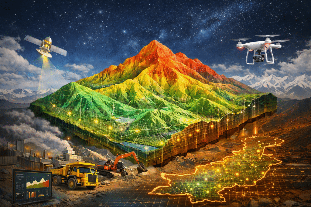
A Digital Elevation Model, or DEM, is essentially a precise three-dimensional representation of the Earth’s surface. Think of it as a highly detailed, data-rich version of a topographic map, except instead of flat contour lines on paper, you get a fully interactive, accurate 3D terrain model that captures every ridge, valley, slope, and fault line in a given area.
DEMs and LiDAR-based terrain models provide detailed 3D maps of the surface, down to individual gullies, ridges, and drainage networks, and are used to detect geomorphological patterns that are known to concentrate mineral deposits.
This level of detail is not just impressive on screen. It is genuinely transformative for exploration teams working in complex and often remote terrain like the mineral belts of Balochistan, Khyber Pakhtunkhwa, and Gilgit Baltistan.
Why Digital Elevation Modelling Matters for Mineral Exploration
The connection between terrain and mineralization is deeper than most people realize. The shape of the land, the way water drains, where faults have shifted rock formations over millions of years, all of these surface and near-surface features carry critical clues about what lies beneath.
In the oil and mining industries, DEMs are utilized for geological exploration, resource management, and site development, with elevation data helping to identify potential mineral deposits, plan extraction operations, and manage environmental impacts.
When TMR Mining & Exploration deploys Digital Elevation Modelling as part of an exploration program, we are not just producing a pretty map. We are generating actionable intelligence. The 3D terrain data we compile allows our geologists to identify fault systems, trace structural trends, locate areas of geological interest, and prioritize targets for further investigation, all before committing significant capital to ground-level operations.
This is the kind of smart, data-driven approach that separates modern mineral exploration from the trial-and-error methods of the past.
From Topographic Data to Exploration Strategy
The process of building a useful DEM begins with data acquisition. At TMR Mining & Exploration, we compile topographic data from multiple sources including satellite imagery, aerial photography, drone-based surveys, and geophysical datasets. Each source contributes a layer of information that, when integrated, produces a rich and highly accurate picture of the terrain.
Through drone-based imaging, a digital elevation model or digital terrain model can be rapidly generated and alteration and mineral signatures detected remotely, reducing footprint, cost, and risk for field workers while enabling explorers to generate targets remotely.
Once the raw data is compiled, our team processes it to generate the 3D terrain model. From there, we can extract slope maps, drainage basin analyses, lineament maps that highlight structural features like faults and fracture zones, and shadow relief models that reveal subtle topographic patterns invisible to the naked eye.
Digital Elevation Models and Digital Surface Models generated from UAV imagery or LiDAR are widely applied in estimating stockpile volumes, analyzing slope geometries, and assessing mineral reserves, and have been shown to outperform traditional surveying techniques in terms of accuracy, speed, cost efficiency, and safety.
The result is a foundation for exploration decision-making that is grounded in real data rather than assumptions.
Supporting Mine Design and Infrastructure Planning
Digital Elevation Modelling does not stop being useful once exploration targets are identified. As a project moves into mine design and feasibility stages, DEMs become essential tools for planning the physical infrastructure that will support operations.
Road corridors need to be routed through terrain that minimizes both cost and environmental disturbance. Waste rock dumps need to be sited in areas that will not cause erosion or contaminate water systems. Processing facilities need to be positioned to take advantage of natural topography. Every one of these decisions is informed by accurate elevation data.
High-resolution sensors, drones, and multispectral imaging allow for real-time, continuous collection of geological and environmental data, and when these inputs are combined, they create highly accurate digital representations of mine sites that help companies effectively plan extraction and minimize disruption.
At TMR Mining & Exploration, our Digital Elevation Modelling service ensures that mine design decisions are made with the best possible spatial data from the very beginning, saving clients significant time and cost down the line.
Environmental Impact Assessment Through DEM Technology
One of the most important applications of Digital Elevation Modelling that often gets overlooked in the exploration conversation is its role in environmental impact assessment. Pakistan’s mining sector is increasingly operating under tighter environmental regulations, and rightly so. The country’s mountain ranges, river systems, and ecosystems are precious, and responsible mining requires understanding exactly how a project will interact with the surrounding landscape before operations begin.
DEMs allow environmental teams to model how water will flow across and through a project area, where sediment might be mobilized during heavy rainfall, which slopes are at risk of instability, and how visual and physical impacts of a mine will extend into the surrounding environment. This kind of analysis is not just good practice. It is increasingly a regulatory requirement for project approvals in Pakistan and internationally.
TMR Mining & Exploration: Delivering DEM Services Across Pakistan
Pakistan’s mineral potential is extraordinary. From the copper-gold systems of Balochistan to the base metal deposits of KPK and the Gilgit Baltistan, the country offers some of the most exciting exploration opportunities in the world. But unlocking that potential requires modern tools, experienced geologists, and a commitment to data-driven decision-making.
That is exactly what TMR Mining & Exploration brings to every project. Our Digital Elevation Modelling service is not an add-on. It is a core part of how we approach exploration, mine planning, and environmental assessment. We integrate DEM data with our field reconnaissance work, our geological mapping programs, and our geophysical survey outputs to deliver a complete and coherent picture of every project area we work in.
Combining various data sources such as geophysical, geochemical, and drilling data for a holistic subsurface view leads to enhanced decision-making, increased efficiency, cost savings, and risk mitigation by identifying and addressing potential risks early in the project lifecycle.
Whether you are at the early exploration stage, moving into resource estimation, or planning mine infrastructure, our team has the expertise and the technology to support your project with accurate, reliable, and insightful Digital Elevation Modelling.
The Bottom Line
In an industry where every decision carries significant financial and environmental consequences, the quality of your spatial data matters enormously. Digital Elevation Modelling gives exploration companies and mine designers the terrain intelligence they need to make smarter decisions, move faster, and operate more responsibly.
At TMR Mining & Exploration, we are proud to offer this service as part of our comprehensive suite of exploration and mine planning solutions across Pakistan. If you are working on a mineral exploration or mining project and want to know how Digital Elevation Modelling can add value at every stage, we would love to hear from you.
Visit TMR Mining & Exploration to learn more about our full range of services and find out how we can support your next project in Pakistan.