Resource Estimation: Why Accurate Subsurface Data Defines Mining Project Success
INTRODUCTION
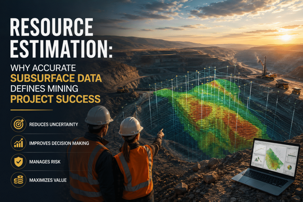
Mining projects often face a critical challenge long before extraction begins. Decisions worth millions depend on how well we understand what lies beneath the surface. Yet, early-stage assumptions are frequently built on limited drilling data, leaving room for uncertainty that can derail planning, financing, and operations.
This is where Resource Estimation becomes essential. It forms the backbone of technical and financial decisions, guiding everything from feasibility studies to investment strategies. However, without strong supporting data, even the most advanced estimation models can produce unreliable results.
At TMR, we have seen this gap firsthand during field operations across varied terrains. Our geophysical surveys help bridge it by providing continuous subsurface insights that drilling alone cannot achieve. By integrating these datasets, we support more confident and defensible resource models.
In this article, we explain the challenges behind resource estimation, how geophysical surveys strengthen it, and why this integration matters for modern mining projects.
The Industry Challenge: Uncertainty in Resource & Reserve Estimation
Resource estimation has always been a complex process, but the pressure on accuracy has increased significantly. Investors, regulators, and stakeholders now expect greater transparency and confidence in reported figures. Despite this, many projects still rely heavily on sparse drilling data, especially during early exploration stages.
Drilling provides direct evidence, but it only samples a small portion of the subsurface. Between drill holes, assumptions must be made. These gaps can lead to misinterpretation of ore body continuity, geometry, and grade distribution. As a result, errors in Resource & Reserve Estimation can propagate through the entire project lifecycle.
We have encountered situations where promising deposits were underestimated due to limited spatial coverage. In other cases, overestimation led to costly revisions during feasibility stages. Both scenarios create financial and operational risks that could have been mitigated with better data integration.
Another challenge lies in geological complexity. Faulting, alteration zones, and varying lithologies can distort interpretations if not properly understood. Without supporting geophysical data, these features often remain hidden until later stages, when changes become more expensive to address.
The industry is moving toward more integrated approaches, but gaps still exist. Bridging these gaps requires methods that provide continuous, scalable, and cost-effective subsurface insights.
TMR’s Approach: Strengthening Resource Estimation with Geophysical Surveys
At TMR, we approach Resource Estimation as a multidisciplinary process. Geophysics plays a central role by filling the spatial gaps between drill holes and improving geological understanding.
Our methodology begins with careful survey design. We select techniques based on the deposit type, geological setting, and project objectives. Magnetic surveys are often used to map lithological boundaries and structural features. These are particularly effective in identifying faults and intrusions that influence mineralization.
Gravity surveys help detect density contrasts, which can indicate ore bodies or alteration zones. In sedimentary or structurally complex environments, this method provides valuable depth insights that drilling alone cannot offer.
Electromagnetic surveys are especially useful for detecting conductive mineralization such as sulfides. In several field projects, we have used EM data to refine drill targeting, reducing unnecessary drilling and improving hit rates.
Data acquisition is only part of the process. We place strong emphasis on processing and interpretation. Noise reduction, data correction, and inversion modeling allow us to convert raw measurements into meaningful subsurface models.
These models are then integrated with geological and drilling data. This step is critical. Rather than treating geophysics as a standalone dataset, we use it to inform and refine the geological framework that underpins resource estimation.
In one of our field experiences, integrating magnetic and EM datasets revealed structural controls that were not evident from drilling alone. This led to a revised geological model and a more accurate estimation of resource continuity.
Our approach ensures that geophysical data contributes directly to better decision-making, not just additional information.
Key Benefits of Integrating Geophysics into Resource Estimation
When geophysical surveys are properly integrated into Resource & Reserve Estimation, the impact is both practical and measurable. It improves not only the accuracy of estimates but also the efficiency of exploration programs.
Here are some of the key benefits we consistently observe:
- Improved accuracy of geological models
Continuous geophysical data helps define boundaries and structures more clearly, reducing uncertainty between drill holes. - Reduced exploration costs
Better targeting means fewer unnecessary drill holes, saving time and operational expenses. - Enhanced risk management
Early identification of geological complexities allows teams to adjust plans before costly errors occur. - Faster project timelines
With clearer subsurface insights, decision-making becomes more efficient, accelerating project development. - Stronger investor confidence
Reliable and transparent resource estimation supports more credible reporting and financing discussions.
These benefits are not theoretical. We have seen projects move from uncertain early-stage interpretations to well-defined resource models simply by incorporating geophysical insights.
The value lies in integration. Geophysics does not replace drilling, but it makes every drill hole more meaningful.
From Data to Decisions: TMR’s Integrated Workflow
A structured workflow is essential for turning geophysical data into actionable insights. At TMR, we follow a process that aligns with international best practices and reporting standards.
We begin with survey planning, where geological objectives guide method selection and survey parameters. This ensures that data collected is relevant and usable for resource estimation.
During data acquisition, quality control is a priority. Field conditions can be challenging, from rough terrain to environmental noise. Our teams apply rigorous checks to maintain data integrity.
Processing follows, where raw data is corrected and enhanced. Techniques such as filtering, leveling, and inversion are applied to produce reliable subsurface representations.
The final and most important step is integration. Geophysical results are combined with geological mapping and drilling data within a unified model. This model supports Resource & Reserve Estimation by providing a more complete understanding of the deposit.
This workflow aligns with globally recognized frameworks such as JORC and NI 43-101, which emphasize transparency and data quality. While geophysics alone cannot define a resource, it significantly strengthens the confidence in interpretations used for reporting.
We also acknowledge limitations. Geophysical methods are indirect and require careful interpretation. Results depend on contrast in physical properties, which may not always be present. That is why integration with geological data is essential.
By following a disciplined process, we ensure that geophysical surveys contribute meaningfully to resource estimation rather than adding uncertainty.
CONCLUSION
Accurate Resource Estimation depends on more than drilling data. It requires a clear and continuous understanding of the subsurface, supported by reliable and integrated datasets.
At TMR, we combine field experience with technical expertise to deliver geophysical surveys that strengthen geological models and reduce uncertainty. Our approach helps clients make informed decisions with greater confidence.
If you are planning a mining project or refining an existing resource model, we invite you to connect with our team. A well-designed geophysical program can provide the clarity needed to move forward with certainty.