How Remote Sensing Is Helping TMR Find New Mineral Targets
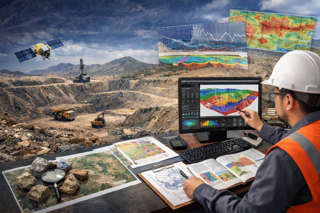
At TMR Mining Exploration, one of the leading mining consultants in Pakistan, finding mineral potential starts long before boots hit the ground. One of the key tools behind smarter and faster exploration is remote sensing, a technology that uses satellite and aerial imagery to spot surface clues that may point to valuable mineral deposits below.
Whether you are planning a new exploration campaign or looking to optimise an existing one, understanding how modern geophysics services and geological surveying services in Pakistan can transform your results is essential.
What Is Remote Sensing in Mineral Exploration?
Remote sensing allows TMR to capture detailed images of large, often inaccessible areas using advanced sensors. These include multispectral and hyperspectral cameras that can “see” far beyond the range of the human eye. Different minerals reflect light in unique spectral signatures, and by studying these patterns, TMR’s expert team can identify surface materials that may signal the presence of valuable ore deposits.
This approach is a core part of TMR’s geophysics services in Pakistan, enabling rapid, non-invasive reconnaissance of terrain that would otherwise require costly and time-consuming ground surveys.
How Remote Sensing Data Is Analysed and Applied
The real strength of remote sensing lies in how the data is interpreted and actioned. Images collected from satellites and aerial platforms are processed by TMR’s specialists, who look for mineralisation patterns and geological structures linked to known deposit types. This expert analysis forms a critical component of TMR’s geological surveying services in Pakistan, helping to narrow down areas of higher prospectivity long before any physical sampling begins.
By applying proven data interpretation methods, TMR reduces uncertainty early in the exploration cycle helping clients invest their resources where they are most likely to yield meaningful returns.
Integrating Remote Sensing with GIS for Smarter Exploration
TMR combines remote sensing data with Geographic Information Systems (GIS) to create a comprehensive, single-view exploration intelligence platform. This integration brings together terrain data, geology, and mineral indicators on one clear visual map, making fieldwork planning significantly more accurate and efficient.
As trusted mining consultants in Pakistan, TMR leverages this combined approach to support better decision-making at every stage of exploration, from initial target generation through to drill planning and resource estimation.
The Key Benefits of Remote Sensing for Mineral Exploration in Pakistan
Pakistan’s diverse and largely underexplored geological terrain makes it one of the most promising regions for mineral discovery in South Asia. Remote sensing, when combined with comprehensive geophysics services and geological surveying services in Pakistan, offers several major advantages:
Faster target identification: Large areas can be screened in a fraction of the time it would take using traditional ground methods, significantly accelerating the early stages of exploration.
Lower exploration costs: Reducing the need for wide, blanket ground surveys significantly lowers overall project expenditure, freeing up budget for high-priority targets.
Improved decision-making: Data-driven insights enable TMR’s team and its clients to prioritise the most prospective zones with greater confidence and precision.
Responsible exploration: Minimal ground disturbance during the early screening phase supports environmentally responsible project development, an increasingly important consideration for stakeholders and regulators alike.
TMR’s Commitment to Modern, Responsible Exploration
As technology continues to evolve, TMR remains committed to using modern tools to explore both responsibly and effectively. Remote sensing is just one part of a broader suite of services spanning geophysics services in Pakistan, geological surveying services in Pakistan, and full-spectrum project management that sets TMR apart as a trusted exploration partner in the region.
Whether you are a junior explorer, a major mining company, or a government body seeking to unlock Pakistan’s vast mineral wealth, TMR’s integrated approach delivers the insights you need to explore smarter and with greater confidence.
Partner with TMR, Pakistan’s Trusted Mining Consultants
Ready to take your mineral exploration to the next level? Get in touch with TMR today to learn more about our remote sensing capabilities, geophysics services in Pakistan, and geological surveying services in Pakistan. Let us help you find your next major discovery.