Why Geological Mapping Is Key to Mining Success in Pakistan
Pakistan is sitting on one of the most extraordinary mineral fortunes on the planet. Estimates suggest the country holds mineral resources valued between $6 trillion and $8 trillion, including major deposits of copper, gold, lithium, rare earth elements, coal, iron ore, and chromite. And yet, despite being located on one of the world’s richest mineral belts, Pakistan contributes just 0.15% to global mineral output and only 2 to 3% to its national GDP, and out of 92 known minerals, nearly 90% remain unexplored.
So, what’s holding things back? There are many factors at play including infrastructure, policy, and investment, but one of the most foundational and often overlooked is geological mapping. Without it, even the richest mineral belt in the world is just guesswork.
What Is Geological Mapping and Why Does It Matter?
Think of geological mapping as the blueprint before the build. Before a single drill bit touches the ground, mining teams need to understand what’s beneath their feet, the rock types, fault lines, mineral indicators, and structural formations that tell the story of what a region holds.
Geological maps provide a bird’s eye view of the surface and subsurface distribution of various types of rocks and economic minerals found in a particular region. These maps are essential for all future detailed geological works including mineral exploration, civil engineering, soil surveys, and land use projects.
In short, geological mapping is not just a technical exercise. It is the very first and most critical step in determining whether a mining project is viable at all.
Pakistan’s Geological Potential Is Real But Underutilized
The numbers speak for themselves. Recent discoveries include an estimated $74 billion in copper-gold at Reko Diq over 37 years, and PKR 700 billion in gold discovered in Attock in 2025, highlighting the transformative potential of Pakistan’s resources.
The Tethyan Tecto-magmatic and Metallogenic Belt creates a globally recognized porphyry copper-gold and base metals mineralized zone that straddles western Pakistan, making the country home to one of the world’s most significant porphyry copper-gold mineral reserves spanning approximately 2,200 kilometres.
Yet despite this incredible geology, Pakistan’s mining sector remains underdeveloped due to challenges including inadequate infrastructure, weak technical and financial investment, poor regulatory and data transparency, and security and access risks in remote mineral-rich regions.
This is precisely where professional geological mapping services become a game-changer.
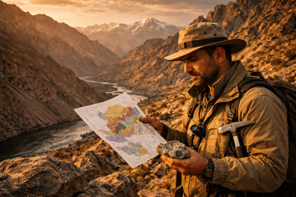
The Role of Field Reconnaissance in Unlocking Pakistan’s Mineral Wealth
Field reconnaissance is the on-the-ground work that makes geological maps accurate and actionable. It involves geologists physically traversing target areas, studying outcrops, collecting samples, observing fault structures, and documenting mineralization patterns, all before any heavy equipment is deployed.
The Geological Survey of Pakistan has been tasked with detailed geological mapping to identify untapped reserves, a move that underscores just how central this discipline is to the country’s broader mining ambitions.
But government efforts alone cannot cover Pakistan’s vast and often remote terrain. Private sector expertise, driven by experienced mining consultants in Pakistan, is essential to fill the gaps and accelerate exploration timelines.
How TMR Mining & Exploration Approaches Geological Mapping
At TMR Mining & Exploration, geological mapping is not just a checkbox. It is a comprehensive, multi-layered process designed to deliver results that actually move exploration projects forward.
When it comes to structural mapping, TMR’s field teams systematically document geological formations including faults, folds, and stratigraphic sequences. Understanding these structures is critical to predicting where mineralization is likely to occur at depth. Alongside this, targeted sampling strategies ensure that every specimen collected contributes to an accurate picture of the deposit through careful geochemical and petrographic analysis.
Modern geological mapping does not stop at what you can see on foot either. TMR integrates satellite imagery, aerial photography, and geophysical data to cross-reference field observations and sharpen the accuracy of exploration targets. The end result is a detailed, high-resolution geological map that guides drilling programs, resource estimation, and strategic decision-making, saving clients both time and significant capital investment.
Why This Matters for Pakistan’s Mining Future
Experts caution that commercial-scale production will require years of sustained work, including comprehensive geological mapping, environmental assessments, and industrial infrastructure.
The good news is that momentum is building. Pakistan has launched a National Minerals Harmonization Framework, digitized geological data, and revitalized the Geological Survey of Pakistan to enhance transparency and improve the ease of doing business in the minerals sector.
International attention is also intensifying. Pakistan’s diverse geological landscape is home to vast mineral deposits including copper, gold, lithium, antimony, and other critical minerals, and the country has undertaken initiatives to improve its mining business and investment environment to make it easier for companies to enter the market.
For companies looking to enter or expand in this space, working with experienced mining consultants in Pakistan who understand local geology, terrain, and regulatory nuances is not optional. It is essential.
The Bottom Line
Pakistan’s mineral wealth is not a myth. It is a documented, globally recognized reality that is finally beginning to attract the investment and policy attention it deserves. But turning geological potential into mining success requires rigorous, precise, and professional geological mapping as the foundation.
Without accurate maps, exploration is guesswork. With them, it becomes strategy.
TMR Mining & Exploration brings the field expertise, technical capability, and local knowledge to make that transition happen, from the first rock sample to the final exploration report. If you are serious about mining in Pakistan, start where every successful project starts: with the geology.
Interested in professional geological mapping and field reconnaissance services across Pakistan? Get in touch with TMR Mining & Exploration today.