Geochemical Sampling in Mineral Exploration: How TMR Mining Identifies High-Value Deposits
What Is Geochemical Sampling?
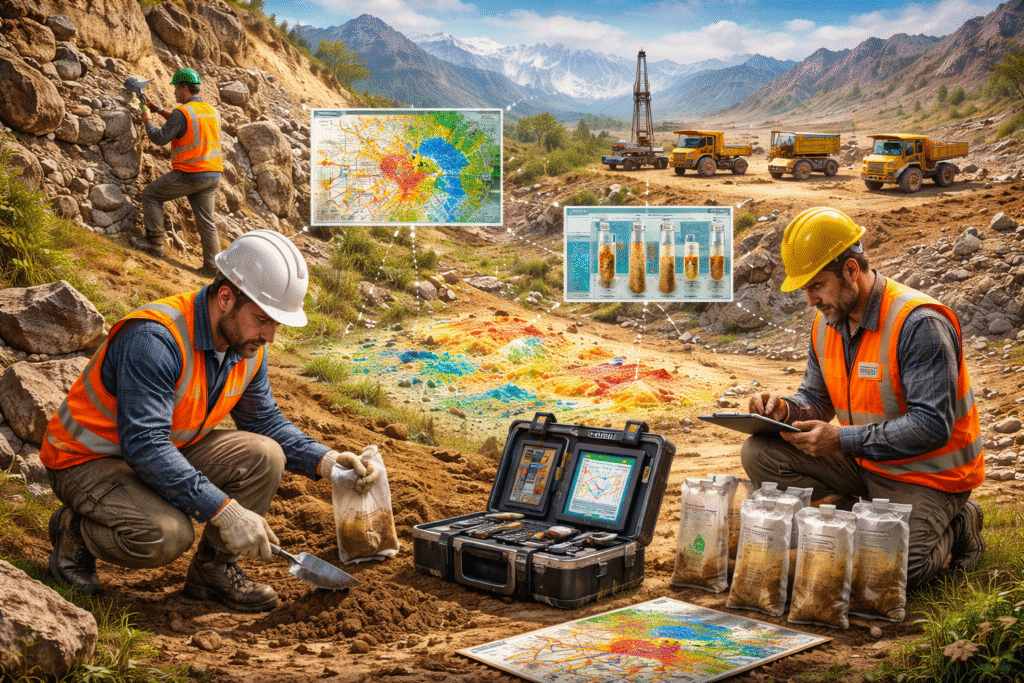
Geochemical sampling is the systematic collection and laboratory analysis of earth materials such as soil, rock, stream sediment, and vegetation to detect chemical signatures that indicate underlying mineral deposits. It is one of the earliest and most cost-effective tools in any mineral exploration programme, enabling geologists to prioritise target areas before committing to expensive drilling campaigns.
At its core, the method is built on a fundamental principle: mineralised systems disperse trace amounts of ore-forming elements into surrounding soils and rocks through weathering, hydrothermal activity, and secondary transport. By measuring these elemental concentrations using precise laboratory techniques, exploration geologists can map the invisible chemistry of the Earth’s surface and identify anomalous zones that warrant further investigation.
Key Principle:
Geochemical sampling is a critical component of mineral exploration, one that TMR Mining has embedded into every exploration workflow, from target generation through to resource delineation.
The discipline draws on organic and inorganic chemistry, geology, statistics, and data science. Modern geochemical programmes integrate multi-element analysis, spatial statistics, and Geographic Information Systems (GIS) to transform raw sample data into actionable exploration intelligence.
Why Geochemistry Is Foundational to Mineral Exploration
Before any drilling rig is mobilised or a mine plan is drafted, exploration teams must answer one fundamental question: where are the minerals? Geophysical surveys can identify structural anomalies, and geological mapping reveals surface rock types. However, it is geochemistry that directly fingerprints the chemistry of potential ore bodies.
For Pakistan, a country sitting atop one of the world’s most mineralised tectonic corridors, robust geochemical programmes are not optional. The Tethyan Metallogenic Belt, stretching through Balochistan, Khyber Pakhtunkhwa, and Gilgit-Baltistan, hosts world-class copper-gold porphyry systems, sediment-hosted base metal deposits, and significant iron ore occurrences. Yet vast areas of this terrain remain underexplored. Systematic geochemical sampling is the most practical means of advancing this frontier.
The Economic Case for Early-Stage Geochemistry
Drilling costs in remote terrain can run to tens of thousands of dollars per hole. An effective geochemical programme, by comparison, costs a fraction of that investment and significantly improves the probability that drill targets are genuinely mineralised.
The return on investment is not merely financial. It also reduces environmental disturbance by concentrating physical exploration activities on areas of genuine merit.
TMR Mining’s Geochemical Methodology
At TMR Mining & Exploration, geochemical sampling is integrated into a holistic exploration framework that spans target generation, field execution, laboratory analysis, and data interpretation. Our team, led by qualified geoscientists with experience across Australia, Africa, and Asia, brings international best practice to every project.
Designing the Sampling Strategy
Effective geochemical sampling begins well before any field team is deployed. Our geologists study existing geological maps, remote sensing data, historical reports, and structural interpretations to design a sampling programme tailored to the target type and geological context.
Key design considerations include:
- Grid spacing and orientation: Designed relative to deposit size, expected anomaly dimensions, and dominant structural trends.
- Sample medium selection: Soil, rock chip, or stream sediment chosen based on terrain, vegetation cover, and target commodity.
- QA/QC protocols: Blanks, standards, and duplicates inserted at defined intervals to ensure data integrity throughout the programme.
- Spatial representativeness: Sample locations selected to ensure the dataset is genuinely representative of the entire target area.
By designing effective sampling strategies, TMR ensures that collected samples accurately represent the exploration area, eliminating spatial bias that could lead to false negatives or missed mineralisation.
Types of Geochemical Samples Explained
| Sample Type | Best For | Terrain Suitability | Exploration Stage |
| Soil samples | Gold, copper, zinc, lead | Weathered profiles, semi-arid | Regional to detailed |
| Rock chip samples | All commodities | Outcrop-rich terrains | Early-stage reconnaissance |
| Stream sediments | Broad regional surveys | Drainage systems | Regional reconnaissance |
| Float rock | Tracing mineralised float | Alluvial fans, glacial terrain | Target localisation |
| Outcrop/channel | Grade estimation, structure | Exposed bedrock | Detailed/resource stage |
The choice of sample medium is one of the most consequential decisions in a geochemical programme. Different media capture different parts of the geochemical dispersion system, and the optimal choice depends on the target commodity, climate, terrain, and stage of exploration.
TMR’s field geologists are trained to select the appropriate medium based on a rigorous assessment of surficial geology, climatic weathering regimes, and expected geochemical dispersion models. In Pakistan’s arid Balochistan terrain, residual soil sampling, combined with rock chip sampling of exposed veins and altered zones, forms the backbone of TMR’s reconnaissance programmes.
Laboratory Analysis and Elemental Concentration Testing
Once samples are collected in the field, they undergo a rigorous chain of custody before reaching the laboratory. Proper labelling, bagging, cataloguing, and transportation are not administrative formalities; they form the foundation of data defensibility under JORC and NI 43-101 reporting standards.
Sample Preparation
At the laboratory, soil samples are typically dried, sieved to a standardised fraction (commonly minus 80 mesh or minus 180 microns), and pulverised to ensure homogeneity. Rock samples are crushed and split before pulverisation. These preparation steps are critical, as analytical results are meaningless without representative sub-sampling.
Analytical Techniques Used by TMR
TMR works with accredited commercial laboratories to apply the most appropriate analytical methods for each element suite:
- Aqua regia digestion + ICP-MS/OES: The industry standard for multi-element geochemical surveys, measuring 40–60 elements simultaneously with detection limits at parts-per-billion levels.
- Fire assay (Au, Pt, Pd): The gold standard for precious metal analysis, required when exploring for gold, platinum group elements, or silver in porphyry and epithermal settings.
- X-ray fluorescence (XRF): A rapid and cost-effective method for analysing major elements and selected trace elements.
- Gas chromatography–mass spectrometry (GC-MS): Applied in surface and organic geochemical investigations, particularly in hydrocarbon-bearing basins.
- Portable XRF (pXRF) for field screening: Provides real-time elemental data in the field to guide sampling decisions. It is used as a screening tool, not a replacement for laboratory analysis.
Laboratory analysis determines the elemental concentration within each sample, typically expressed in parts per million (ppm) or parts per billion (ppb). When analysed spatially and statistically, these values reveal the geochemical architecture of the prospect.
Interpreting Geochemical Data to Delineate Prospective Zones
Raw elemental data from the laboratory is valuable only when properly interpreted. This is where geological expertise, such as that provided by TMR’s senior team, transforms numbers into exploration decisions.
Statistical Analysis: Defining Anomalies
The first step is to establish the geochemical background, meaning the natural, undisturbed elemental levels for a given rock type and terrain. Anomalies are values that deviate meaningfully from this background.
Common statistical methods include:
- Mean-plus-standard-deviation thresholds
- Boxplot analysis and probability plots
- Robust statistical techniques for skewed datasets
- Cumulative frequency analysis for defining anomaly cut-offs
Spatial Analysis and GIS Mapping
Anomalous values are plotted using GIS software to generate geochemical maps. These maps reveal spatial patterns of mineralisation, whether linear (suggesting structural control), elliptical (indicating a porphyry centre), or irregular (suggesting supergene redistribution).
TMR’s GIS and data management team ensures that all spatial data is accurately registered and integrated with geological, geophysical, and remote sensing datasets.
Multi-Element Pathfinder Associations
Ore deposits are rarely defined by a single element. Copper porphyry systems, for example, are typically associated with pathfinder elements such as molybdenum, gold, silver, and specific copper-to-zinc or lead ratios.
Recognising these multi-element signatures, and understanding how they change with depth and distance from the ore source, is critical for accurate interpretation.
Key Insight:
The interpretation of geochemical data helps delineate prospective zones, providing valuable insights into the presence and character of mineral deposits. This approach improves exploration accuracy, reduces the risk of missing mineralised areas, and supports informed decision-making throughout the exploration process.
Geochemistry in Pakistan’s Tethyan Belt and Beyond
Pakistan holds a strategically important position in global mineral exploration. The Tethyan Metallogenic Belt, extending through Balochistan into the Chaghi and Reko Diq districts, hosts some of the world’s largest undeveloped copper-gold porphyry systems.
Despite this potential, systematic geochemical surveys across much of Pakistan’s mineral-rich terrain remain incomplete. TMR Mining & Exploration was established in part to address this gap, bringing international exploration methodologies to local projects and presenting findings in formats that attract global investment.
Commodities Covered by TMR’s Geochemical Programmes
- Copper and Gold (Porphyry): Chaghi District, Balochistan
- Iron Ore (BIF and Detrital): Multiple provinces
- Zinc-Lead (Sediment-Hosted): Carbonate sequences in northern and western Pakistan
- Rare Earth Elements (REE): Carbonatite and clay-hosted targets
- Chromite, Graphite, Manganese, and Industrial Minerals: Across diverse geological domains
TMR also operates geochemical programmes in Australia and Africa providing a comparative understanding of geochemical signatures across varied geological terrains.
JORC and NI 43-101 Compliance in Geochemical Programmes
For exploration results to be reported publicly, whether in ASX announcements, TSX filings, or investor presentations, the underlying geochemical data must meet strict reporting standards.
TMR Mining’s programmes are designed with compliance in mind from the outset. This includes:
- Documented sampling procedures: Full written protocols for sample collection, labelling, storage, and dispatch
- QA/QC programmes with certified reference materials: Standards, blanks, and duplicates inserted at defined intervals
- Accredited laboratory selection: Laboratories with appropriate national or international certifications
- Competent Person sign-off: All publicly reported results are reviewed and approved by a qualified Competent Person under JORC or NI 43-101
This rigorous approach ensures that TMR’s geochemical data is scientifically credible, compliant, and ready for investor reporting.