How TMR’s Geophysical Surveys Are Redefining Mineral Exploration in Pakistan
Introduction
Pakistan sits atop one of the most mineral-rich geological corridors in the world. The Tethyan metallogenic belt stretches across the north, while Balochistan hosts copper-gold porphyry systems comparable to some of the largest deposits in Asia. Yet despite this enormous potential, a significant portion of these resources remain undiscovered or poorly defined. Why? Because traditional exploration methods, when applied without rigorous subsurface investigation, frequently miss what lies beneath the surface.
Geophysical surveys in Pakistan have historically been underutilised in early-stage exploration. Many projects have relied on surface mapping and geochemical sampling alone, bypassing the subsurface intelligence that modern geophysics provides. The result is wasted drilling expenditure, missed targets, and frustrated investors.
At TMR, we work with mining companies, project developers, and government bodies to change that. In this post, we explain how our integrated geophysical survey methodology delivers the subsurface clarity that exploration in Pakistan demands, and why the approach we take produces better outcomes from the very first survey campaign.
Why Conventional Exploration Falls Short in Pakistan’s Complex Geology
Pakistan’s geology is anything but straightforward. From the highly folded and faulted terranes of Khyber Pakhtunkhwa to the thick sedimentary sequences overlying potential targets in Sindh, subsurface conditions vary dramatically across the country. This complexity is precisely why surface-level exploration so often leads teams astray.
A mining consultant in Pakistan faces a distinctive set of challenges. Cover sequences can mask mineralisation entirely. Structural complexity creates false targets. In mountainous terrain, access limitations mean that drilling blindly is not just expensive; it is often logistically impossible.
Mineral exploration services that do not incorporate geophysics at an early stage are, in effect, working with incomplete data. A geochemical anomaly on the surface may point generally toward a prospective area, but without knowing the subsurface geometry, dip, and continuity of a target, any drilling programme carries significant risk.
This is the fundamental gap that geophysical surveys are designed to close. By measuring physical contrasts in the subsurface, such as variations in density, magnetic susceptibility, electrical resistivity, or seismic velocity, we can build a three-dimensional picture of what lies beneath, before a single drill hole is collared.
TMR’s Integrated Geophysical Survey Approach
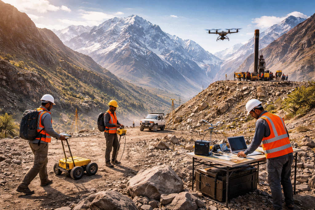
At TMR, we do not offer a single-method solution. Mineral systems are complex, and no single geophysical technique captures all the information needed to define a target with confidence. Our approach is deliberately multi-method, designed around the specific geology and objectives of each project.
For projects where magnetic contrasts are expected, we deploy ground magnetic surveys to map lithological boundaries, structural corridors, and alteration halos associated with mineralisation. Magnetic surveys are particularly effective in identifying magnetite-bearing systems and mapping intrusive contacts, which are critical in porphyry copper exploration.
Where the target involves conductive mineralisation, such as sulphide-hosted systems, our electromagnetic (EM) survey programmes identify conductors that may represent massive sulphide lenses or disseminated mineralisation. EM surveys are fast to acquire and cost-effective over large areas, making them well-suited for regional target generation.
Gravity surveys complement magnetic data by responding to density contrasts. In areas where intrusive bodies, sedimentary basins, or structural features control mineralisation, gravity data adds a layer of depth sensitivity that surface methods cannot provide.
For projects requiring detailed resistivity mapping or the identification of disseminated sulphides, we conduct Induced Polarisation (IP) surveys. IP is one of the most powerful tools in base metal exploration, capable of detecting chargeability anomalies in the subsurface that strongly correlate with sulphide content.
In specific geotechnical and near-surface applications, Ground-Penetrating Radar (GPR) provides high-resolution imaging of shallow features, while radiometric surveys support geological mapping by detecting variations in natural radioactivity associated with certain lithologies and alteration types.
Down hole surveys complete the picture. Once drilling begins, we deploy down hole geophysical tools to measure physical properties directly within the drill hole, extending the interpretive value of surface data and guiding further targeting decisions.
What TMR’s Geophysical Surveys Deliver in Practice
For exploration companies and investors, the value of a well-designed geophysical survey programme is measured in outcomes, not just outputs. Here is what our clients consistently achieve when they engage TMR:
- Reduced drilling risk: By defining targets geophysically before drilling, we eliminate speculative holes and focus the drill rig on high-priority intercepts.
- Lower overall exploration cost: A targeted survey programme costs a fraction of a misplaced drilling campaign. Geophysical data is reusable across multiple exploration stages.
- Faster target advancement: Integrated geophysical datasets accelerate the progression from reconnaissance to resource definition, shortening the path to project viability.
- Better geological understanding: Geophysical models inform structural interpretation, lithological mapping, and alteration zonation, providing context that field geology alone cannot supply.
- Investor-grade documentation: Well-processed, professionally reported geophysical data strengthens project credibility with investors, joint venture partners, and regulatory bodies.
These are not abstract benefits. In the context of seismic surveys applied to basin-scale targets, or EM surveys over polymetallic prospects in northern Pakistan, the practical value of subsurface data is reflected directly in exploration efficiency and capital allocation.
From Survey Design to Geological Model: TMR’s End-to-End Process
A geophysical survey is only as good as the process that surrounds it. Data acquisition in the field is one step in a structured workflow that begins long before the first reading is taken and continues well after the last instrument is packed away.
At TMR, every survey programme begins with a detailed design phase. We review available geological maps, previous exploration data, and any existing geophysical datasets to define survey objectives, select appropriate methods, and plan acquisition parameters. Survey design decisions, including line spacing, sensor orientation, and acquisition frequency, have a direct bearing on data resolution and interpretive value.
Data acquisition is carried out under strict quality control protocols aligned with international best practices. Our field teams operate with calibrated equipment, conduct regular instrument checks, and maintain detailed field logs. In challenging terrain, where much of Pakistan’s most prospective ground is found, we adapt acquisition methodology to ensure data quality is not compromised by access constraints.
Processing and interpretation follow a structured sequence. Raw data is processed using industry-standard software to remove noise, apply corrections, and produce enhanced datasets suitable for geological interpretation. The processed data is then integrated with geological, geochemical, and structural models to produce a coherent subsurface picture.
The final deliverable is not simply a series of geophysical maps. It is an integrated interpretation that directly informs the next stage of exploration, whether that is a drill targeting programme, a resource estimate, or a feasibility study. This end-to-end commitment to data quality and geological integration is what distinguishes a credible mineral exploration service from a data-collection exercise.
Advancing Mineral Exploration with Confidence
Pakistan’s mineral endowment is substantial, and the interest from domestic and international operators continues to grow. What has historically limited progress is not the absence of mineralisation; it is the absence of the right subsurface data to find it efficiently.
Geophysical surveys in Pakistan, when properly designed, acquired, and interpreted, fundamentally change the risk profile of an exploration programme. At TMR, we bring the technical depth, field experience, and integrated methodology to make that difference real for our clients. If you are planning an exploration campaign and want to understand how geophysical methods can be structured to meet your specific project objectives, we would be glad to discuss the options with you. Contact the TMR team to arrange a consultation or learn more about our mineral exploration services across Pakistan and the wider region.