TMR Mining: Strategic Drill Planning That Drives Results
Introduction
Every unnecessary drill hole costs money the project cannot recover. Yet across the industry, teams still sink capital into poorly located holes because the subsurface picture was incomplete before the rig arrived. The problem is rarely a lack of ambition; it is a lack of structured, data-led planning upstream of the bit.
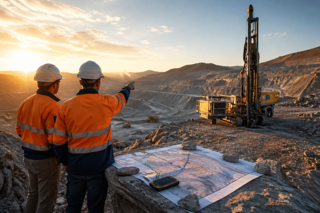
At TMR Mining & Exploration, we work as your dedicated drilling consultant from the earliest stages of target generation through to final resource reporting. Our role is to make sure that when steel hits ground, it is hitting the right ground, at the right angle, with the right sample spacing to answer the geological questions that matter.
This article explains how strategic drill planning, supported by modern geophysical survey methods, transforms exploration outcomes. You will learn how we frame the problem, how we build a drill programme that is both technically sound and economically disciplined, and why the quality of pre-drill data is ultimately the biggest driver of project success.
Why Poorly Planned Drill Programmes Cost More Than the Holes Themselves
A misplaced drill hole is rarely just one wasted interval. It triggers a cascade: revised geological interpretations, re-mobilisation of equipment, delayed resource estimates, and the kind of investor uncertainty that follows when results fail to match predictions. We see this pattern repeatedly, particularly on early-stage mineral exploration projects where the pressure to “get drilling” outpaces the rigour of planning.
The root cause is almost always a gap between the geological model and the physical data used to build it. Teams rely on surface mapping and historical records that may be sparse, inconsistent, or collected under different targeting philosophies. When the model is underconstrained, drill collars get placed on confidence rather than evidence.
A mining consultant with genuine geophysical capability closes that gap before it becomes expensive. Modern geophysical surveys, run correctly and interpreted in context, reveal structural controls, lithological contacts, alteration patterns, and density contrasts that cannot be inferred from outcrop alone. They reduce the degree of uncertainty that sits beneath every drill decision.
The industry has long understood this, but execution remains inconsistent. Survey data is often collected, briefly reviewed, and then shelved rather than integrated systematically into drill targeting. That disconnect between data acquisition and drill programme design is where value is lost, and where a well-structured consulting engagement makes the clearest difference.
How TMR Approaches Drill Programme Design: From Survey to Collar
Our process begins well before a drill contractor is engaged. We start by auditing all existing data: historical drill logs, rock chip results, any available airborne or ground geophysics, and regional geological maps. This gives us a clear picture of what is known, what is assumed, and what remains genuinely open.
From that baseline, we design a fit-for-purpose geophysical survey programme to fill the critical knowledge gaps. The choice of method depends on the commodity, the host geology, and the likely geophysical contrast of the target. For iron oxide copper-gold systems, for instance, we commonly deploy ground magnetic surveys alongside induced polarisation (IP) to simultaneously define structural corridors and map disseminated sulphide mineralisation. For nickel sulphide targets hosted in mafic and ultramafic sequences, airborne time-domain electromagnetic (TDEM) surveys often provide the first-pass depth penetration needed to prioritise drill sectors.
Gravity surveying plays an increasingly important role in our toolkit, particularly where lithological density contrasts can differentiate fertile intrusive bodies from barren equivalents, or where structural density lows indicate zones of hydrothermal alteration. We process all gravity data with full terrain correction and tie it rigorously to the regional Bouguer network to ensure the anomalies we are chasing are real, not artefacts of topographic influence.
Once the geophysical data is collected, it enters a joint inversion and interpretation workflow alongside the existing geological model. We do not treat geophysics as a standalone product. We treat it as a layer of evidence that must be reconciled with lithology, structure, and geochemistry before any collar is placed. The output is a ranked drill target list with defined dip, azimuth, and depth parameters, and a clear statement of the geological hypothesis each hole is testing.
This structured approach means that every metre drilled is advancing a defined question, not simply filling space on a map.
The Real Benefits of Working with a Dedicated Drilling Consultant
The advantages of a specialist consulting engagement are most visible at the project economics level, but they begin with technical discipline and flow through to every downstream decision. Here is where clients consistently tell us they see the clearest value:
- Reduced drilling cost per unit of geological information. Tighter targeting means fewer holes are needed to define a resource envelope or test a structural corridor. Savings regularly exceed the cost of the geophysical survey programme that enabled them.
- Faster resource definition. When drill holes are positioned to test the maximum extent and orientation of mineralisation from the outset, resource models converge more quickly. Projects that might require three drill campaigns to define an inferred resource can often achieve it in two.
- Lower technical risk for capital decisions. A well-constrained model supported by integrated geophysical data gives management and investors greater confidence in resource estimates. This matters when decisions about pre-feasibility studies or development financing depend on the quality of the underlying geology.
- Improved safety and operational planning. Understanding subsurface structure, groundwater indicators, and rock mass behaviour before drilling reduces unplanned downtime and helps contractors plan rod handling, fluid management, and casing programmes correctly.
- Regulatory and reporting compliance. Our programmes are designed from the outset to meet JORC Code and equivalent reporting standards, so the data collected is not just geologically useful but reportable without remediation.
For project developers and investors in mineral exploration, these outcomes translate directly to a more defensible asset at each stage of the development pathway.
Integrating Geophysical Data with Geological Models: Industry Best Practice
The standard that separates high-quality drill planning from average practice is the degree to which geophysical data is truly integrated with the geological model, rather than displayed alongside it. This distinction matters more than it might appear.
In a standard workflow, a geophysical map might sit on a GIS layer next to a geological map, and a geologist draws connections visually. In an integrated workflow, the physical property models derived from geophysical inversion are directly constrained by the lithological and structural framework, and drill targets emerge from the overlap of anomaly character, geological plausibility, and deposit analogue criteria. This is the approach recommended by the Society of Economic Geologists and reinforced in resource estimation guidelines from institutions such as the Australasian Institute of Mining and Metallurgy (AusIMM).
At TMR, we build three-dimensional geological models that incorporate constrained inversions of magnetic susceptibility, chargeability, and density data simultaneously where data allows. These models are updated iteratively as drill results come in, so the programme can be adapted mid-campaign when new information changes the interpretation. Adaptive drilling, guided by real-time model updates, is now widely regarded as best practice on sophisticated exploration projects, and it is standard practice in our consulting workflow.
We also document the geological hypothesis behind every drill hole in a format that satisfies competent person requirements. This means that if the hole fails to find what it was targeting, the negative result is still interpretable and adds value to the evolving model rather than simply adding to drill cost.
This level of technical rigour reflects the kind of consultancy support that serious mining companies expect, and it is the standard to which every TMR programme is held.
Drilling Smarter Starts Before the Rig Arrives
Strategic drill planning is not an overhead. It is one of the highest-return investments a mining or exploration company can make, particularly in the early stages when capital is constrained and every result shapes the project’s trajectory. The combination of disciplined geophysical survey work and rigorous model integration is what separates programmes that define resources efficiently from those that generate data without direction.
As a specialist drilling consultant and mining consultant with hands-on experience across a range of commodity types and geological settings, TMR Mining & Exploration is equipped to support your programme from target generation to drill-ready status, and to keep refining the model as results come in.
If you are planning a new mineral exploration programme or looking to improve the return on an existing drilling budget, we invite you to reach out. Our team is happy to review your current data, discuss your targets, and outline how a structured consulting engagement could improve your outcomes.
Contact TMR Mining & Exploration today to request a consultation.